Showing posts with label Virginia. Show all posts

Sunday, March 3, 2013

Pyrite Mine Trail at Prince William Forrest Park

Or the "scenic loop to the pyrite mine but is actually a few trails put together" is what it should be called instead of Pyrite Mine Trail.  It's a good thing S had AllTrails on his phone so we could tell if were on track or not.  It would have been a shorter hike if he hadn't.

We parked at the Turkey Run Educational Center and walked to the Turkey Run Ridge Trail.  This trail is 1.4 miles and follows dark blue blazes.  It wasn't very scenic...being winter and all.  Towards the end, it does follow the stream a bit.  We didn't encounter many on this part of the trail.  It is a relatively easy trail with not much elevation gain.


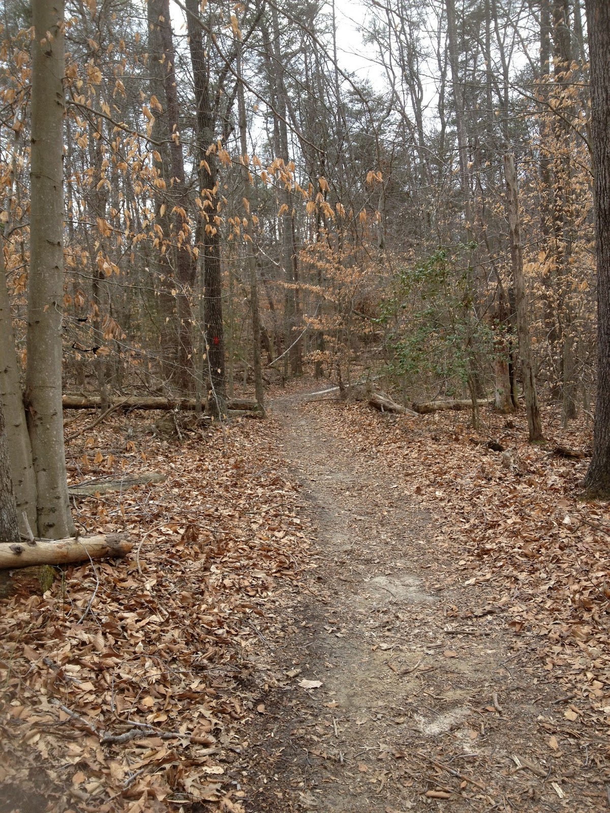
For the most part it's trees, trails, leaves, and that's about it this time of year.  It was really quiet.  I mean we didn't hear birds, squirrels, much of anything at this point of our hike.  It was rather interesting.  I mean, I thought for sure we'd at least encounter a squirrel or two by now.  


I have this thing about photography fungi.  I find them to be interesting with all their sizes, shapes, colors, and where they grow.  They just photograph so neat and look so cool.

We trekked on...the Turkey Run Ridge Trail intersects at the South Valley Trail.  This is long trail, but we were only on a portion of the trail.  The South Valley Trail is 8.7 miles and is the longest trail in the park.   It's marked with a white blaze.

This part of the South Valley Trail is a bit more hilly than the Turkey Run Ridge Trail.  There were a few leg burning climbs up root infested, rocky, narrow sections of trail.  These types of inclines seemed to come at perfect intervals.  There were just enough for my out of shape legs to handle.

The trail follows the South Fork of Quantico Creek.  There are a few photo ops in the beginning with some small-ish water falls.  It was pretty and made for a more interesting section of trail.  Of course, I had to stop to photograph the little water falls.  They were prettier than the brownish grey of all the other scenery.

We came upon this tree.  I thought it was really strange to see a bald tree.  I mean, all the bark is completely off the tree and it lies in a pile at the base of the tree.  I said it must have been completely infested with termites and the woodpeckers have pecked the crap out of it for the bark to completely fall off like that. It was the strangest thing I think I had seen as far as trees go.  I just had to share that.  It just looked bizarre.

The creek does open up and gets wider at this point.  There are a few more little water falls.  As witnessed by this photograph.  Also, you can see S's finger.  He climbed down this slope to take this photo for me.

I know the last time we were here for car camping, there was some part of the creek where we all climbed out on the rocks to take a picture, but it was never posted on the Internet for me to snag..

I think this was the steepest part of our trek today.  I know I've done a lot of whining about how my legs aren't getting stronger and it just seemed like no matter how many trips we took I'm always huffing and puffing at the tops of these inclines.  Well, today I wasn't.  Even though we haven't been out hiking for almost a month, I climbed this and was a little winded at the top, but not as bad as before.


S said I should get down on my knees and take this photo to make it look stepper than it actually was.  And the top wasn't really the top.  It did continue a upwards a little bit after the top of this picture.

At the intersection of South Valley Trail and North Valley Trail, we got a little lost.  The AllTrails trail looked like we were to turn left and go up the Pyrite Mine Road.  But shortly after, we realized that wasn't where we were supposed to be.  I thought I had found the little jog that connected us to the larger trail, but it turned out to be a wrong way.  I mean like there's not even a trail there wrong way, as you can see here.  


SO we turned back to the intersection to see if maybe there was something we missed.  Maybe a trail we didn't see?  Should try instead?  *shrugs*  We walked back and crossed a rather large bridge....which I didn't photograph for some reason.  We turned left up a gravel trail and immediately I noticed boundary signs.  I thought, "That's weird."  But we kept hiking.

We noticed a rather large private residence up on a hill and some private property signs on the opposite side of the trail.  I was wondering where this was leading, but S said we were headed in the right direction now.  So, we kept hiking.  And then...low and behold


Eureka!  We have it!  The North Valley Trail!  LOL  This is a 2.6 mile trail that is marked with a light blue blaze and follows along Quantico Creek, too.  We continued on this, which will take you to the old pyrite mine site.


As we were sitting there munching on the homemade, chewy granola bars I made, I was thinking, "What properties does pyrite have for there to be a need to mine it?  I should look that up when we get home."  Yeah...I didn't read the sign.  As we walked down the trail, S said, "Do you know why they mined for pyrite?"  I told him I was going to look that up when we got home.  LOL  Apparently, pyrite has a large amount of sulfur which is used in glass, soap, bleach, textiles, paper, dye, medicine, sugar, rubber, and fertilizer.  Interesting.  Did not know that.

I also asked him if it reclaimed itself, as sometimes mother nature does, or if it had help.  He said they planted about 5000 trees as the land was so decimated that it couldn't reclaim itself.  There are a couple of other scenic stops along this trail.

After crossing a bridge, we continued up the North Valley Trail.  I think if we had started off in this direction, we might have had a better chance of following the trail and not getting lost, BUT we didn't.  LOL

Here is another one of the scenic stops along this trail.  It's the pyrite mine's foundation.  There are three main buildings to the mine site.  There is also a commissary building that I didn't take a picture of.

For the most part, this trail is pretty level.  There are a few small hills, but that will change when you get towards the end of this part of our loop.  There are some pretty steep inclines where you will have to scramble over many roots.  The trail is pretty narrow at times, but is very scenic; following Quantico Creek.

At this point, my legs are feeling heavy.  My knee is sore.  My ankle, which I twisted the other day walking the dog, is bugging me.  We've had to stop three times for my feet, which I don't think was too bad at this point.  I mean, we have been hiking for quite a while and have stopped more for shorter trips.  Yet, I press on and just keep hiking.

It doesn't appear that we're still on the trail at various points through out trip.  It's like whomever marked this trail on AllTrails did some whack hiking and went all over the place.  OR their GPS wasn't marking them correctly one of the two.  As long as we're headed in the same general direction, it's all good, right?

We hit another intersection.  Oh great!  Where are we supposed to go now?  It doesn't look like we're on the trail AT ALL now.  LOL

We decide to turn left and head towards parking lot E on the Quantico Falls Trail.  This is a short stint between the North Valley Trail and the Lake One Road.  But I'm thinking, we're not parked at parking lot E.  How do we get from parking lot E to the Turkey Run Educational Center?  Oh well, I guess we'll figure that out when we get there.

That trail dead ends at Lake One Road.  We turn left, away from parking lot E and it looks like we're on the trail, but shortly after, we're not on the trail any more.  It's as if we were supposed to turn left in the woods somewhere that's not a trail.  I have no clue how this person who marked this trail actually DID hike it.

So...we turned around...again.  At this point, I pulled out the trail map from the park and figured out that we could take the Mary Bird Branch Trail back to the Turkey Run Educational Center and the truck.

This is a .5 mile trail between the Lake One Road and Old Black Top Road.  There are LOTS of downed trees.  It's a very low lying area and several boardwalks carry you over mucky and muddy sections of the forest.


Then you will cross the creek and start to ascend back towards Turkey Run Ridge, the educational center, and the parking lot.  At this point, my legs are SERIOUSLY bugging me.  I'm waiting for my hips to start acting up, too.  We stopped one more time for my feet, which I thought was pretty good.  They weren't KILLING me, but thought I would prevent that from happening.  I remember this part of the trail from our car camping trip here earlier.  This was hell for me on that trip, but not so much now.  Maybe there is something to these legs building some strength after all?

We reach the top of the trail and have hit the road that takes us back to the truck.  YAY!


So, all in all we've learned NOT to trust any trails posted and to do more research on trails before we take them, if possible.  I know I wasn't much help last night when he picked it.  I think I was sleeping from my 2 rita dinner....  LOL  This park has tons of trails with many loop combinations.  We highly recommend a visit here if you can.


Saturday, February 23, 2013

Bull Run Mountain

Bull Run Mountain was a nice day trip. We started off at the visitors center where they had a couple of bird feeders which automatically caught the eye of C. I thought we would never hit the trail lol. After a few minutes I was able to get her attention and we were out the door and heading towards the trail. It was a cold snowy day and the trail had maybe a inch or so of snow cover.

Our first point of interest on the trail was Chapmans Mill which was built in 1742 by the Chapmans that produced wheat and corn. It burnt down in 1998. There are also some other ruins there.
From there the trail rose uphill gradually for 2.2 miles. Along the way we passed a few other hikers and a couple of trail runners. I was little amazed there were actually others out here with the weather conditions. As we are still noob hikers we are learning that there are a lot of others that enjoy the raw conditions. 
Once we arrived at the top of Bull Run Mountain *as we huffed to catch our breath after the last bit of elevation gain kicked our unfit butts* we were treated to some very nice views. We spent a bit of time there taking pictures, eating a protein bar and just soaking up the amazing treat we earned.


We took a different trail down. Sorry I can not remember the name of the trails we took as I writing about it almost a month later. ON the way down we encountered a very rapid and steep elevation drop. *whew* Glad we didn't come up that way. Along this trail we came across a few neat things of nature. There was a mountain stream , some of it was frozen and some where not. We took a few pictures of some neat ice formations of of logs.


We really enjoyed this hike and the location is real close to where we live, so we will probably return several more times in the future.

Sunday, January 27, 2013

G. Richard Thompson Wildlife Management Area

Man that IS a mouthful!!  GRTMA is in the middle of nowhere...I really should have read more about where we were going and taken a GOOD map and print out of a description of the loop.  I...did not.  I am such a hiking noob it's not even funny.

The GPS took us completely to the wrong parking area.  No wonder we got off on the wrong trail.  We were hiking  the AT and thought we were on the loop.  Now that I look at the maps a little better, we were no where NEAR the loop we were trying to hike.  *sigh*

We're driving along this road that keeps getting narrower and narrower and losing it's surface.  Eventually, it's down to a dirt/gravel concoction that has GYNORMOUS pot holes in it.  Good thing we didn't try to drive the mustang that day!  We never would have made it!

Now, I did read that this is a hunting area so be sure to wear some orange, which we didn't.  *snort*  I must say though, it was the weirdest thing for us to hike around and hear gun shots going off.  Or rifle shots, I guess you'd call them?  Being SO not a hunter, I honestly have no clue.

When we got out of the truck, we were immediately greeted by a dog with a radio collar and bells on.  It was adorable!  Not quite sure what kind of dog it was.  It looked like a cross between a golden and an Irish setter.  I've not quite seen that breed before and well, when I was single (or pretending to be as the ex worked nights) I used to watch the dog shows just to learn the different breeds.

We checked the map, geared up and hit the trail.  The hunting party went left and we went right.  I figured we were on the right path as it was a loop.  *shaking head*  Jackson apparently wanted to join us on our hike instead of his hunting family.  I finally told Jackson to come with me and headed towards his family.  He caught up with them and I turned around and headed back up our trail.

It was a warm day.  We immediately started to strip layers.  I'm not sure what the temperature was that day, but I think it got up to at least 40 if not low 50s.  I really was warm.

The trail we were on started with a brief walk through the woods to some plains type grass lined trails.  This was short lived and we were in the woods again.  This was definitely going to be a muddy trip when we had to walk partly down a small stream on the trail.  It's all good!  Boots were meant to get wet and dirty!

We were following white blazes.  *snort*  Such noobs we are!  LOL  We just keep walking through the woods.  Up some inclines, down more hills; we just keep swimming walking and following those white blazes.  Sorry, a little habit from that Nemo movie.  At one point, I stop and say, "Do you hear water?"  S, "Yup."  We trek down this descent into a gorge with giant rocks and a nice stream.

There were some large logs that you could cross, but it was more fun to scramble over the rocks.  I started to cross on one of the logs, but S just flew past me walking over the rocks.  This is where I really enjoy having trekking poles.  Crossing water is SO much easier to accomplish with trekking poles.  I never feel like I'm going to completely lose my balance and fall into the water.  They help me take larger steps than I would have.  With my knees and feet, I never know what's going to give first, so I'm always hesitant to just step not knowing what's going to give if I over-exert myself.  I know it's not the best way to hike, but with my health issues, I don't want to over do it until I get them all resolved.  Of course, that requires actually GOING to the doctor...

At this point, we start to climb....up and up and up.  The trail we were supposed to be one was going to take us around a lake and around almost the perimeter of the park.  Where's the lake?  Where's the trail?  What's the white blazes and why are we seeing signs for shelters?

Once we crest, I have signal and realize that we're no where near the trail we were supposed to actually hike.  *snort*  Go figure!  I figure out, using Trimble Outdoors, that if we walk on this trail, then cut right, we can get to the loop we were looking for.  So we continue.  And up we go...some more.  At some point, I will NOT be heaving when we get to the top of an incline.  I seriously need to work on my lung capacity.  *sigh*


And now my feet are starting to kill me.  I finally had to stop and we decide, well, it's been 3 miles and we wanted to do a 6 mile hike today.  We have no clue where the trail is or that we're even on the right trail, so we begin the decent back the way we came.  At this point, I'm almost convinced that I need to ditch the initial insoles I have for my "issue" and just continue with lifting of the big toe so that it supports the weight it's supposed to.  At this point, I'm baffled and getting tired of it...  SOMETHING'S gotta give...

I'm dying by the time we get back to the car.  I didn't have my brace as it was supposed to be a "moderate" hike and I forgot to put it on when I got dressed.  So, now my knee is killing me and my hip is starting to hurt.  So, I'm going downhill quickly and just can't wait to get back to the car.  How much longer?  1 mile.  How much longer?  Half a mile.  How much longer?  We should be there.  Where's the car??  I'm tired and want to go home!!  YES!  *happy dancing*  FINALLY!  There's the car!

Now we get to drive BACK on that road that is wide enough for only one car.  And wouldn't you know...TWO other cars were headed our way on the way out of the park.  Doesn't that figure?

It's interesting to note that the directions back home were different than the ones we followed to get there.  On the way home, we pass almost all of the other parking areas that made much more sense than the ones we followed.  I should have really made note of the other parking areas and where they were located so we could actually hit the right trail next time.  There was a group of Koreans that passed us and we passed them on the way home.  Next time, I think we're going to find the lake and park there to hit the right trail!

Monday, January 21, 2013

Sky Meadows

We awoke to the threat of snow....and were giddy!  Hiking in the snow??  Hell yeah baby!  We were excited to say the least.  We had already decided to hit a Sky Meadow Trail the night before. We opted for the North Ridge, South Ridge, Gap Trail loop.  It's about 3.5 miles, but COULD be be about 4.5 with an offshoot out and back off the North Ridge Trail that takes you to the AT.

We have our morning coffee, shower, pack up, feed the dog, feed ourselves and hit the road.  There wasn't a drop of rain or snow when we headed west on 66.  However, the farther west we drove, the more precipitation we saw.  I was excited...like a fat kid with their own cake.  Now I'll see if we really can do this 4 season...

We arrive at the entrance only to find a note on the door.  Um...no one's home.  Please put your entrance fee in this envelope.  We will trust you.  Ooooookay.  At this point, there is some small amount of accumulation that we can see on the roads and trees.  I love snow!!

Stupidly, we forgot a map....and didn't have good cell service to pick up a map on one of the MANY aps on our phones.  At some point, I will bite the bullet and subscribe to one so we can download maps to our phones, but right now, it's not been an absolute necessity.  We drive to the visitor's center.  Yup, nobody home there either!  Great!  Now what?  The kiosk isn't printing maps.  WTF does the trail start?  We really should be more prepared on these day hikes.  Seriously.  We could do something completely stupid and get totally lost or something.  It has been known to happen... hasn't it?

Luckily, a ranger drives up in the truck and we ask where the trial head is.  He was nice enough to point out the large sign across the way.  There's only 2 parking lots and everything pretty much starts and ends here.  Good to know!  Also, he shared a word to the wise about fog.  We need to be careful, because if the fog rolls in we won't be able to see that far ahead of us.  Good to know!  Thanks!  :)

We cross the street and head down the gravel road that pretty much leads to all trails.  The Gap trail is farther down the road, but we opted to start with the North Ridge Trail, and turn right up the stairs.  At this point, there's about 1/2 an inch to an inch of snow on the ground now?  It's pretty frozen, too.  I think there was some snow earlier in the week and it has simply refrozen.  These suspicions will be confirmed later on in the hike.

The North Ridge starts out with a decent incline.  It was a nice warm up.  I honestly swear at some point I will not heave like a chain smoker walking up a flight of stairs.  Seriously...it's getting annoying.  It's like my lung capacity is MUCH shallower than most.  It didn't used to be that way!  I need to start singing again to get it back maybe?  In any event, on we trek!

We start out hiking through a bit of field on the edge of woods.  It's a nice little scenic trail that winds into the trees about halfway or less?  I'm not measuring miles or anything...  But it does start some decent inclines not that far along the trail.  At this point, I can really see that there was snow at some point earlier in the week that has refrozen.  Some parts of the trail were slick because of this refreezing of snow.  I'm thinking, "This might be easier with some Yak Trax or something like that.  I'd have better grip and not wear myself out having to push harder to make it up the hill due to crap traction."

There are bits and pieces of old stone walls such as this one along the trail.  As you can see, the snow  was coming down at a pretty decent rate and there was a nice dusting over everything.  It was really peaceful and quite for the most part.  We didn't encounter many if any on the trail.  I love hiking both with groups for fun, and then in pretty much solitude for just the two of us.  This was the later of the two, that's for sure!

We climb, up and up and up.  I'm not sure how much of an elevation gain we did on this trek.  I think it was around 800 ft?  I'm too lazy to check right now.  It was a rather nice climb up a small-ish summit.  I noticed some tracks in the snow that were not human....or human friend.  I think they were bunny tracks.  They looked neat in the snow.  The bunnies were pretty active on this part of the trail, too.  There were several bunny prints on the trails.  I didn't take a picture though.  I should have.  Would have made for a neat picture.

We climbed the North Ridge trail up the mountain, crossed a stream a few times, and came to the intersection of the South Ridge Trail.  The North Ridge continues for .5 mile to the AT.  If you chose to take this .5 mile out and back, it makes for what most call the 4.5 mile loop.  However, it's actually 3.5 miles if you follow it as an actual loop without any jutting off of the loop.  There are several strategic benches along the trail.  I leaned against the one at this intersection to take some pressure off my feet.  They were okay, but starting to irritate me a bit.  :(

We opted to turn left and continue on the loop and not do the out and back part.  The South Ridge part of the loop was a bit rough.  There were some downed trees to maneuver under or over.  They hadn't cleaned much of that trail up from I'm guessing all the summer storms we had.  I didn't mind it so much.  It wasn't unbearable, but did make us feel like this was a pretty secluded trail that's not used much.  I really like those trails...the ones that aren't well used and are rather rustic.  I'd really like to be part of the starting a trail or helping a baby trail to grow.  lol

At this point, I couldn't tell if the snow had stopped, or if we were just in the woods and the trees were catching the snow.  There was about a decent inch at this point, I think.  It made for some pretty fun hiking.  As you can see, there's not many tracks in the snow at this point.  A little further along the South Ridge trail, we noticed some running tracks, I think?  of two people?  At least that's what it looked like to me.  Or make the same person twice?  *shrugs*  Then closer to the visitor's center, there were more human tracks and some human friend tracks now.  

It wasn't too cold.  I wasn't cold at all.  I had layered enough to keep myself dry and warm.  S had to strip a layer, I think at some point.  I probably should have, too, but I wasn't sure I'd be warm enough in just a base layer with my shell on top.  After our car camping debacle, I'm always afraid of getting too cold.  I probably wear a few more layers than needed, but until I get some more good gear and possible some mid layers, I will probably keep the base layer and the fleece jacket, which I LOVE!  It's so nice and warm!  And does the perfect job of wicking away my sweat perspiration.

The South Ridge trail leads you back down the mountain.  The decent isn't too steep, with but with the slick layer of ice under the snow, I had to be careful not to slip and fall on my arse.  It almost happened a few times.  Eventually, the snow stopped and more tracks appears in the snow.  We knew we were nearing the end of our little hike.  I didn't want to push it on our first snow outing.  I think the Yak Trax or some other ice traction over the show thingy would be best if we were to continue to hike in these conditions.  He has some that I got him for his birthday, but he didn't' put them on that day.

And, as the ranger stated, when the fog rolled in, we couldn't see very far in front of us.  Somewhere in that fog is a small valley with the Visitor's center, park office and a house or two.  They are invisible in this shot.  I wish I had taken one when we first started out so you could compare the two.  *shrugs*  20/20 hindsight.

At the bottom of the trail, there are the remnants of a homestead.  I can't seem to find the name of the ruins, but they're there.  Some stone chimneys and walls are all that remain from these homes of days gone by.  It was a nice settlement they had at the base of the mountain.  There was a nice stream for fresh water and good protection from wind.  Anyway, it's always neat to see things like that.

And with that, we caught up to the Gap trail and headed back to the visitor's center, the car, and then to REI!  LOL  Now, when we got back to the truck, I wasn't cold, but knew my jacket was wet.  When I got in the truck, I was fine, but at some point, the jacket started making me cold and I had to take it off to allow it to dry.  You really do have to watch and make sure your clothes do not stay wet or you don't keep wet clothes on when you're in the cold.  It really could do a number on you quickly.  I quickly took it off, and laid it over my legs, near the car heater to dry off on the way to REI.  Worked like charm!

Oh!  I'll leave you with this impromptu still life...my poles in the snow.


Saturday, January 12, 2013

Second Battle of Manassas


Had I known how this day was going to go, I would have stayed in bed.  *sigh*  Yes, it was pretty bad.  I will have to say, if it wasn't for a hiking trail ap on my phone, we might still be wandering aimlessly in the woods.  This trail IS.NOT.MARKED.WELL.AT.ALL!!!  You would think I would have heeded all the warnings I read online, but NO!

We arrived shortly after the park opened.  After speaking with the ranger, we feel confident!  I mean, he said the trail is marked with clue blazes.  Um...yeah right!

The trail starts across the street.  So, we crossed a busy road to get there and then walk about 1 mile or at least it seemed that way, to get to the trail head.  It had such a promising start, too!  We were following the "Tour" signs which ended at a parking lot.  And there's no blazes...GREAT!

We look right.  There's a sign, but not a trail one.  We look left and there's what appears to be a trail and a sign.  Go left?  Of course the sign is pointed the wrong way and if you follow the arrows, you're heading down a grassy hill to some monuments and not on the path.  I open my trusty ap to make sure we're going the right way.  So, we trek on...to the left.

Now, on the way to the parking lot, we passed a couple.  Remember this for later...So we're trekking and come to a fork.  Now, the sign says it's a horse trail.  There are NO blazes to be seen.  This trail is marked orange.  So, we continue on.  Well, we should have tuned there.  The couple that were ahead of us on the trail are passing us going the opposite direction.  This prompts me to check our progress on my ap.  Yeah...we're not making any.  *sigh*  Back where the horse trail was marked?  Yeah, we should have turned.

And, not only are we off the trail, but my feet decided to start acting up. GREAT! *sigh* Adjusting of the insoles round one. And I seriously don't get it, as we haven't been walking all that long. So, I fix my insoles and we adjust our path to actually be ON the trail. Now I'm beginning to to understand why so many people were complaining about the blazes or lack there of.

We walk and we stop.  We walk and we stop.  We walk and well you get the picture.  By this time, I'm getting really pissed off as this was SUPPOSED to be a walk in the park compared to what we have been doing.  *sigh*  My feet suck.

At one point, there's a new loop off shoot of the main trail.  it takes you through some very strange landscapes.  There's these large piles of wood.  It's as if a tree died and just slowly deteriorated where it stood.  These huge circles of wood were everywhere.  It was truly alien.  I couldn't figure out what would have caused it.

It almost was an out and back loop.  You jut off and then almost do a u-turn and come back but just in a a different trail.  Meh.  It added a mile.  You come out to a monument of some description.  (Pictured here).  As you can tell, I'm not really a history buff...  I didn't read what it was for.  I was trying to figure out where the trail goes.  There's a parking lot in one direction and what LOOKS like train in another direction.  After some surveying of the land, we headed away from the parking lot towards the woods.  Apparently, this was the correct way.

This was called the rock skirmish or something like that.  Apparently, they ran out of ammo and threw rocks.  LOL  This part is a nice stroll in the woods...if my feet weren't killing me.  *sigh*  We  came out of the woods near another parking lot.  NOW which way do we go?  There's what appears to be three trails from here.  We chose the center one.  I opened by ap to make sure.  YUP!


This part of the trail is part of the bridle trail. It follows along farm land or what looked like it was farm land. This trail dumps you out at the highway. We crossed and started walking, but wait! This doesn't make sense. This is a private residence... Back track again.  We were supposed to turn right and cross the OTHER highway.  Still no blazes to tell us UNTIL we crossed the busy road.

We pass some horses, cross a creek, stop several times for my feet and come to the Stone House. It's the trademark of the park. Cross the highway again. By this time, not only my feet hurt, but now my knees and hip are sore as shit. I can see the visitor's center, but holy crap it's so far away! I SO want this hike to be DONE! It was supposed to be easy! WTF??

We climb a hill and I keep over and lay in the grass for a while.  Everything hurts...EVERYTHING!  I feel like the visitor's center is miles away and I'll never make it.  But, I trudge on...as always.

I hurt.  I'm tired.  I'm hungry, thirsty, sweaty, but FINALLY made it to the car.  What should have been an easy trek killed me!  Is it every going to get better?


Friday, December 21, 2012

Prince William Forest Park

Lessons learned in cold weather car camping...and other transcriptions from the Hiking Heffer's Hiking Journal.

S wanted to get back into hiking and camping and doing outdoorsy type stuff.  We'd gone on a couple of hikes on our own, but I had the brilliant idea of joining a hiking group (or 10).  We joined one that was doing a hike with a car camp...and it wasn't far from us!  HORAY!  Except, we had to drive south on 95...during rush hour...on a Friday.  *sigh*  Prince William Forest Park here we come!

Yes, traffic was hideous.  Of course it always is on 95 south.  It really should have only taken us about 45 minutes to get there, but well....

We arrived about an hour before dark and furiously worked to set up the tent for the night.  We haven't set it up in over a year so it took us a little while longer than anticipated to set it up.  We set up the Ritz of tents.  It's  a 6 person but is perfect for the two of us and the air mattress.  More on that later...

K1, one of the event planners, came to introduce herself and invited us over to their campfire, which was nice since we didn't have any wood to start one on our own.  H also stopped by an introduced herself.  Everyone was SO nice!  I was doing a *happy dance* in my head. 

Once the tent was finally finished, we wandered over to the "party" to meet some other members of the group.  First impressions are always fun:

K1 (event planner #1) - a bit on the quirky side, but very nice!
K2 (event planner #2) - quiet, but also very sweet
H - cute.  Very well traveled for what appears to be such a young age.  Smart kid too!
L - Hiliarious!  He had us all laughing pretty hard!

The fire was nice and tasty.  My feet were freezing!!  We practically had our feet in the fire, though, which is not a good thing.  L didn't light the best fire for night 1.  I was starting to doubt whether we'd survive the weekend.  My feet just WOULD NOT get warm. 

We excused ourselves to cook dinner.  We had jalapeno sausages and chips for dinner.  It didn't take long to cook or eat.  I was starving, but still freezing.  *sigh*  Then we rejoined the party for more laughs.  I was so tired and so cold.  I think it was around 9 that we hit the sack, or at least tried to.

Lesson 1 - Now I know what they mean when they say you need to keep dry to sleep warm.  My feet were freezing because they were moist.  I had worn my hiking shoes to work and...well...yes moisture did occur.  And it didn't occur to me to remedy this before it became too late.  I FROZE!

Lesson 2 - Air mattresses and cold weather camping DO NOT go together.  These are things a novice camper just doesn't think about...  Well, I DO NOW!  NO air mattresses for cold weather camping.

I shivered, I shook, I tossed, I turned.  You name it, I did it.  There was no sleep to be had for me, and well consequently for either of us.  I finally gave up after about an hour plus, crawled out of the blankets and sleeping bag, grabbed by bag, and put on not one but TWO pairs of socks.  Magick solution #1!  YES!  FINALLY!  *hears trumpets blaring*  SLEEP!  Which was short lived.

Around 5, the mattress (and my bladder) decided to wake me up.  The air in the mattress was too cold and was simply sucking the body heat out of me.  We both took a trip to the heated bathroom.  Can I just say...thank jebus for heated bathrooms!  *rewind*  A WHILE ago, we received new emergency packs at work and had to turn in the old ones.  I...let's just say...refrained from handing in certain items from the old pack.  A mylar blanket being one of them.  Well, before I left work, I tossed that puppy into my bag.  Boy am I glad I did!!  We opened that sucker up and put it on top of the mattress, but under the blanket that was on the mattress.  This reflected our own body heat  back to us and not allowing it to get sucked into the air core of the mattress.  YES!  Two more hours of sleep!!

We are coffee drinkers.  So, the first thing we did when we got up was put some water on to boil for some coffee.  Well, this drew a crowd.  The party was at our campsite that morning.  K1, H and L all stopped by for a chat, some cocoa, coffee, or mocha.  H brought over her Jetboil and made some oatmeal while we cooked up our breakfast scramble.  After we ate, we joined the rest of the group at K1s campsite where the rest of the members were congregating.

We piled into cars and headed over to the trail head.  Initially I was towards the front of the pack, which was a bit too fast paced for me.  I needed to head to the back.  However, it was like pulling teeth to get people to go in front of me when we stopped!  *sigh*  I am glad we had the trekking poles with us though.  That saved me more ways than one.  I lasted longer on my feet with those things, then if I didn't have them.  And it helped my knees on the descents.  This really was an up and down trail.

However, the trail wasn't all that scenic...  The fall color was pretty much gone.  This is pretty much what it looked like most of the time.  It does wind around the stream at points and that was pretty.  I didn't even see many fungi either.  Cause...I'm obessesed with photographing fungi.  You'll find out later. 


We stopped at a nice part by the stream and ate lunch.  Everyone was snacking on tuna and crackers.  We had kaiser bun sammies.  And I wonder why I'm still a heffer??  *snort*  So as you can see, there are SOME scenie parts of the trail, but...yeah, it was pretty brown most of the way.

The trailhead started at the Turkey Run Education Center.  and followed High Meadows Trail (A trail that begins on the ridgetop and descends to the South Fork of Quantico Creek, including a wide variety of habitats.  2.1 miles (3.4 km)).  Then we picked up the South Valley Trail ("The longest single trail found in the park, includes abundant beaver and other creekside wildlife habitat, with excellent opportunities for wildlife viewing.  9.7 miles (15.6 km)").  Then finally the home stretch on the Turkey Run Ridge Trail ("A moderately difficult trail between the Turkey Run Environmental Center and the South Fork of Quantico Creek.  1.4 miles (2.3 km)").

That last leg on the Turkey Run Ridge Trail was killer!!  My feet were kill me!  My knees were sore and my hip was really sore.  BUT, I trudged on like a trooper.  I was afraid to stop because I wasn't sure I would be able to get up again.  *snort*

Saturkey night camp cire was just as hilarious and fun as Friday night.  There were considerable more people to enjoy!  There was about 16 of us camping that night, but the campfire Satuday night could accomodate us all.  It was excellent!

There was a smorgasboard of food!  We brought our token marshmallows and hot cocoa.  There wasn't anyone starving, that's for sure!  We excused ourselves to cook our burgers.  I was FAMISHED!  Then went back for more fun.  I was toasty warm and tired.  Everyone kept thinking I was asleep, but I wasn't.  I was just enjoying the fire, the company, and the occasionaly haldful of chocolate covered toffee.

Sleeping was MUCH easier!!  K1 brought some extra sleepign bags and S used one Saturday night.  I bundled up in 1 pairs of socks, three shirts, and two pants in our sleeping bag.  I was toasty for a long time, but then some cold air snick in in the wee hours and I had to shift lower into the sleeping bag.  Problem solved.

Strangely enough, I slept past 7!  GO FIGURE!  I honestly thought I was programmed to wake up with the sun.  Who knew?  We packed up and said our goodbyes.  We headed home to pick up Missy...then do 7 loads of laundry. 

So, what did I learn?
Lower temperature sleeping bags are essential, but expensive.  :(
Air matresses SUCK the body heat out of you.  DO NOT use in cold weather.
It's okay to wear many layers to bed when it's cold...and yes I WILL sleep in them.
Rubber shoes will melt when close to the fire.
A teepee shape is a MUST for building a good campefire
Jumbo marshmallows are not better for smores.
You can dehydrate beef stroganoff....